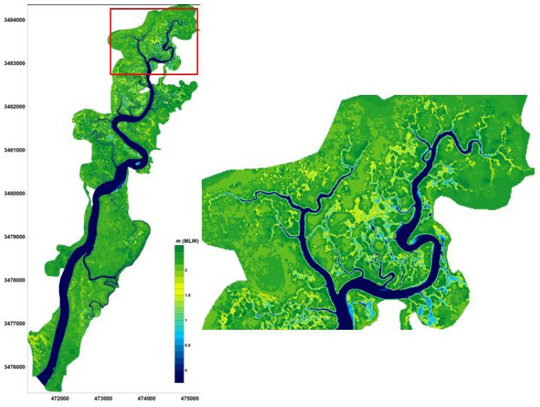
Figure 4: Digital elevation model of the intertidal area surrounding the Duplin River. The right-hand figure is a detailed view of the area north of Hunt Camp.
Figure 4: Digital elevation model of the intertidal area surrounding the Duplin River.
Post date:
Nov 18, 2010