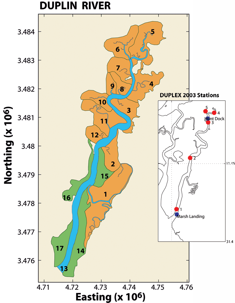
Figure 1: The definition of 17 polygons using aerial remote sensing techniques. Easting and northing dimensions are in meters based on the UTM grid of 1983. Inset shows the distribution of monitoring buoy, from which data were acquired to validate the hydrodynamic model
Figure 1: The definition of 17 polygons using aerial remote sensing techniques
Post date:
Apr 21, 2005
