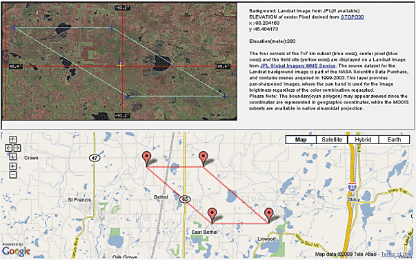
Fig. 1: Location information for Cedar Creek Natural Resources Area LTER site available from the MODIS Subsetting Tool. Image includes a LandSat image served from NASA's Jet Propulsion Lab to the ORNL DAAC's Web Site, along with a Google Map of the Cedar Creek area.