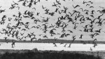
The Virginia Coast LTER Program of the University of Virginia is focused on the Virginia Coast Reserve (VCR) of the Nature Conservancy. Managed by the Conservancy for conservation, research, and education, the VCR extends 100 km along the seaward margin of the Delmarva Peninsula, from near Chlncoteague Inlet southward to the mouth of Chesapeake Bay (latitude 37°30’N and longitude 75°40W). The study area includes 13 barrier islands (14,170 ha), deep inlets, shallow bays, and vast expanses of mud flats and marshes. Elevation ranges from sea level to +9.1 m. Tidal amplitude is about 1.3 rn.
The VCR is located in the coastal marine blome. The climate is dominated by extratropical fronts and tropical storms and hurricanes. Average annual temperature is 14.2°C. Monthly minimum land maximum temperatures are 3.2°C (January) and 25°0 C (July). Precipitation averages 105 cm/yr. Physical factors such as prevailing wind direction, depth to groundwater, and frequency of disturbance (e.g., overwash) exert profound influences on plant species distribution and abundance. Distinct communities include sandy intertidal, open beach, grasslands, shrub thickets, pine forests, mud flats, salt marshes, and estuarine lagoons. Terrestrial vegetation is conspicuously patchy, with sharp transitions and narrow ecotones between communities.
Both short-term, stochastic events (e.g., tropical storms) and long-term, secular trends (e.g., sea level rise) profoundly influence this barrier island-estuarine system. LTER studies thus employ a variety of historical data sources in conjunction with real-time observations and experiments to examine a broad domain of scales of space and time:
- Centenary- to millenial-scale changes in the landmass of islands and marshes are recorded in the sediments (5,000 yr B.P.). We are studying the interrelationships of secular climate change, sea-level rise, island formation and migration, and marsh accretion with data iron, sediment cores (± 100-yr resolution).
- Decadal- to centenary-scale changes in insular and marsh landforms and vegetation are recorded on historical maps and remote imagery. We are studying the interrelationships of storm events and landscape processes such as primary and secondary succession with data from historical records dating back to 1933.
- Annual- to decadal-scale changes in the composition of the landscape, in the biota, and in the ecological and geological processes occurring on this landscape (i.e., productivity, decomposition and sediment deposition/erosion) are determined directly by current observations and experiments.
- Monthly- to annual-scale variation in the measured rates of processes such as primary production are extrapolated to larger scales. Three coupled simulation models, including a biogeochemical process model, a succession model, and a landscape evolution model, are used both to guide and to synthesize studies of processes occurring on different scales or space and time.
Senior staff of the Virginia Coast LTER Program include ecologists, climatologists, geologists, hydrologists, and environmental chemists. Key personnel are drawn from Old Dominion University (ODU) and the Virginia Institute of Marine Science (V1MS), as well as the University of Virginia. Specific LTER projects include studies of Holocene barrier island and inlet geology, with emphasis on island formation and migration in response to sea level rise (Robert Dolan, George F. Oertel [ODUJ); coastal dimatology, with emphasis on dimatic variation and extreme events as driving forces for ecological and geological change (Bruce P. Hayden); wetlands ecology, geology, and hydrology, with emphasis on historical and modem rates of marsh productivity and accretion (Linda K. Blum, Aaron L Mils, Willam K. Nuttle, Willam E. Odum); field studies of primary and secondary succession, with emphasis on the effects of disturbance (e.g., storm over- wash) on observed patterns and rates of succession (Hayden, Raymond D. Dueser, H.H. Shugart, Jr.); modeling of primary and secondary succession, with emphasis on plant life-form, life history, and physical-environmental constraints (Shugart, Lenore Fahrig); modeling of dune aggradation. with emphasis on plant biology, organic matter, sediment supply, and groundwater (Dolan, Hayden, Shugart); modeling of biogeochemical processes, with emphasis on problems cA system aggregation/disaggregation (George M. Homberger, Richard L. Wetzel [VIMS], Joseph C. Zieman); analyses of terrestrial and aquatic productivity, food chains, decomposition, and nutrient dynamics, with emphasis on “source’ and “sink” communities (Blum, Mills, Odum, Zieman, Michael Castagna [ViMSI); and ecology and evolution of insular vertebrates, with emphasis on the assembly of insular communities and the evolution of insular populations (Dueser, J.J. Murray, Jr., John H. Porter). Software and data management are coordinated by Porter.
Faculties include a headquarters building in Oyster, Virginia, with three dorm rooms (capacity 12), equipped kitchen, library, computer (enhanced PC/AT) and wet-lab facilities (555 sq. m). Dry-lab and storage facilities (450 sq. m), vehicles, boats, and general field and laboratory equipment are available on-site. Associated, staffed faculties include the VCR Hog Island Station (Hog Island), the ODU Barrier Island Research Station (Oyster), and the VIMS Eastern Shore Laboratory (Wachapreague). VIMS/ES has a sophisticated flow- through saltwater laboratory. Analytical labs, greenhouses, main-frame computers, end libraries are avaHable at the University and, by prior arrangement, at ODU (Norfolk).
Contact Dr. Raymond D. Dueser, Department of Environmental Sciences, University of Virginia, Charlottesville, VA 22903 for additional information about the LTER program.
Contact Mr. John M. Hall, Virginia Coast Reserve, The Nature Conservancy, Nassawadox, VA 23413 (804) 442-3049 for more documentation about the VGA.
 Enlarge this image