LiDAR image shows a canopy height profile across a narrow transect through a 500-year-old-growth Douglas fir forest. Each dot represents a “hit” and return of a laser pulse. The colors indicate height in meters above the ground. This structural variability creates a wide range of habitats for different wildlife and plant species. (Image courtesy of Tom Spies and Keith Olsen, OSU College of Forestry)
LiDAR image shows a canopy height profile across a narrow transect through a 500-year-old-growth Douglas fir forest.
Post date:
Dec 21, 2010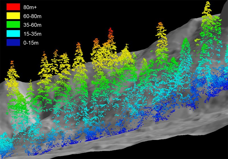
Photo courtesy of:
Tom Spies and Keith Olsen, OSU College of Forestry From:
Light on Leaves