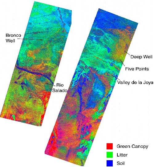
Figure 2. AVIRIS imaging spectrometer data were collected over the Sevilleta National Wildlife Refuge, NM in 1997. The coverage of green canopies, vegetation litter, and bare soils within 20 x 20 m image pixels was successfully measured using a method called hyperspectral unmixing.
Figure 2. AVIRIS imaging spectrometer data
Post date:
Apr 5, 2000