Figure 1. Composite satellite image of the path of Hurricane Georges, which passed over the northern portion of the Lesser Antilles, Puerto Rico, Hispaniola, and Cuba before striking the southern US. The Luquillo LTER site (LUQ) is located in northeastern Puerto Rico and suffered maximum winds from the storm (110 - 130 mph).
Composite satellite image of the path of Hurricane Georges
Post date:
Nov 9, 1998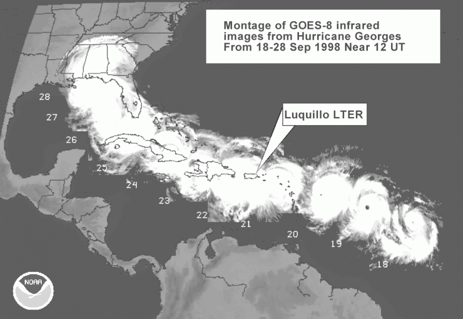
Photo courtesy of:
NOAA web site