An open letter to the LTER community...
October 20, 1992
Dear LTER Colleagues,
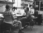
Last year I applied for and was fortunate enough to receive an NSF Mid-Career Fellowship in Environmental Biology to study comparative landscape ecology. I wanted to learn how to use the powerful computer network available at our LTER Network GIS/Remote Sensing Laboratory to compare at nested spatial scales the spatial heterogeneity of the remote sensing scenes that include our LTER sites. The LTER Network Office and staff have been my gracious hosts and trainers.
Consequently, 1992 has been an unusually good year for me and a real challenge. When I arrived in Seattle, I had to learn enough about Unix and vi (a text editor) and a complex of SPARK SUN stations, a Macintosh and a PC before I could begin to get into the software for image analysis and GIS: a maze for any gray matter, especially if the analyst, too, is graying. This was the first time I had dealt with quantitative analyses from such large datasets, or a computer that works all night while I ponder how to keep it busy on succeeding nights.
In spite of the expected frustrations, I have found the whole process demystifying, and rather satisfying. This experience could only have been possible, at least for me, with the break from the press of responsibilities at one’s home institution that a Mid-Career Fellowship can offer. Had I known the technologies beforehand, I could have completed more analyses than I will have when I return home in January 1993.
John Vande Castle and I are working on the Landsat scenes of your sites, comparing them with the other sites’, and calculating vegetation indices for each 1991 thematic mapper scene masked for clouds, cloud shadow and water. We have a long way to go but, when complete, these intermediate products may be of use to you.
Each day, I am reminded of the magnitude of our intersite database as it exists in the remote sensing data from the sites. We have yet to scratch the surface of this resource. We have yet to build an annual time series of such extensive data. Yet, it is not in the least too early to consider and plan for the analyses to be done five, even 10 years from now with this rich database.
One general, long-term goal could be to analyze temporal and spatial heterogeneity of a diverse set of ecosystems at the same grain and at nested sets of spatial scales. A fundamental ecological idea that has reappeared in many forms is that the temporal behavior of ecological systems is influenced greatly by structural complexity. Our ability to deal with this issue in a general way across ecosystems and landscapes is limited, in part, because measures of spatial heterogeneity depend on the scale of measurement, and that differs greatly among our subdisciplines and ecosystems. Remote sensing may provide the only tool we have to observe landscapes as different as forests, lakes and prairies at the same spatial scales.
The University of Washington and the LTER Network Office are good places to spend a year: good colleagues, a good support system, a good library and, for those of you interested in quantitative analyses of the LTER remote sensing database, a powerful facility for analysis.
Sincerely
John J. Magnuson is on research leave at the LTER Network Office in Seattle, Washington from the North Temperate Lakes LTER site and the University of Wisconsin-Madison.
 Enlarge this image