Luquillo Experimental Forest
Hurricane Hugo, a category- four hurricane, struck the Luquillo Experimental Forest (LEF) on September 18, 1989. The maximum sustained winds associated with the hurricane were 225 kph and the three-day rainfall total varied between 165 and 344 mm for different stations within the forest (Larsen 1990).
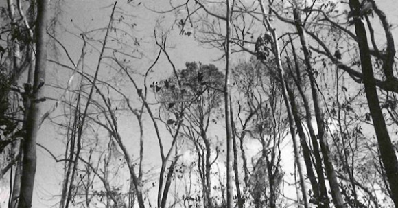
The hurricane winds were predominantly from the north and northeast and, as a result, the extent of damage to forest structure varied with aspect; most north- and east-facing slopes were completely defoliated. Forest damage was also greater on the eastern side of the Luquillo Mountains than on the western side. More than 200 landslides occurred in the Forest in association with the hurricane.
The two principal LTER study sites at El Verde and Bisley were severely affected. All four walk-up towers and the walkway system that provided access to the forest canopy were knocked down. Salvage and reconstruction of these valuable research tools has been hampered by a lack of resources. Meteorological stations, including the NADP sampling station, were put out of commission. Trains and roads were completely blocked and had to be reopened before research could continue. Power, water, and telephone service were interrupted for long periods of time. Study plots and grids were buried under fallen trees and in many cases had to be re-established or abandoned. Access to some plots is still extremely difficult, in some cases hazardous.
Many staff members suffered losses to their homes and property and have had to devote time to these priority problems. Although everyone responded magnificently to the challenge Hugo presented, the site is still operating at less than full staff.
The principal themes of the Luquillo LTER are disturbance and recovery, with the major disturbance types being hurricanes, landslides, treefall gaps, and human effects. The first year of the program (1988- 1989) concentrated on determining the distribution of landslides and treefall gaps and on consolidating the available baseline data on forest structure. Studies of regeneration on landslides and in gaps were initiated as was a study of land-use history and its relationship to forest structure.
The widespread and severe damage caused by Hugo has required a rapid shift in research emphasis from treefall gaps to hurricane damage during the second year. In addition, the numerous new landslides require an expansion of effort in this disturbance type. New landslides are being added to the map developed during the first year and, along with recently acquired aerial photography, wilt provide the basis for a forest-wide assessment of damage to be compared with predictions from models. Much work originally scheduled for later in the first funding cycle has been moved up in priority, and resources are being sought for this expanded effort.
The hurricane has provided a multitude of research opportunities both within the original LTER plan and in new and exciting directions. A paper incorporating the initial assessments of Hugo effects on forest structure, litter and nutrient input, microclimate, stream sediment and organic debris, nutrient export, and plant and animal populations has been submitted for publication, and many others will follow. In these efforts, we must acknowledge the contribution of our colleagues from Coweeta, who donated two months of scientist time to help us get through the initial frenzy of data collection. We look forward to sharing future results both with Coweeta and the other members of the LTER Network.
For further information contact Robert B. Waide, Center for Energy and Environment Research, University of Puerto Rico, GPO Box 3682, San Juan PR 00936.

