The composite research site offers attractive opportunities for scaling ecosystem research from plot to slope to watershed under controlled conditions
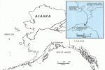
The Bonanza Creek Experimental Forest (BNZ) LTER site is the northernmost forested site in the LTER Network. The research opportunities offered by BNZ are being materially expanded in 1994 through collaboration with the Caribou-Poker Creeks Research Watershed (CPCRW). The CPCRW is a 10,400 ha upland research site 45 km north of Fairbanks, established in 1969 and dedicated to research into hydrologic and environmental questions in the discontinuous-permafrost boreal forest (taiga) of the Yukon-Tanana Uplands of central Alaska.
Site Characteristics
The Caribou-Poker Creeks Research Watershed encompasses more than a dozen first-, second-, and third-order subdrainages over an elevation range from 210 to 826 m msl, allowing analysis of a stream system continuum from headwaters through fourth-order streams. It lies in the zone of discontinuous permafrost; south-facing slopes are generally free from permafrost, while valleys and north-facing slopes are underlain by frozen ground at shallow depth.
The vegetation reflects typical subarctic patterns: north slopes are characterized by black spruce, ericaceous shrubs and a thick feather moss/sphagnum moss/lichen ground cover and deep organic matter layer; south-facing slopes support forest stands of varying age classes of aspen, birch and lesser amounts of white spruce and black spruce. Valley floors are generally poorly drained and underlain by permafrost, and support dense stands of shrub birch, blueberry, willows and associated shrubs and forbs. The stream valleys and lower slopes also support sedge fens and sedge tussock communities. As is typical of the taiga of central Alaska, CPCRW has been affected by wildfire and present vegetation patterns reflect that fire history. Facilities at CPCRW include a central “headquarters” with rustic cooking, dining, and bunk facilities; a field laboratory at the confluence of Caribou and Poker creeks which is supplied with generator power; and a 25-km network of access trails connecting research and monitoring sites throughout the research basin.
The Watershed program was designed from the outset to accommodate both nondestructive research and active landscape manipulation. Early research addressed characterization of hydrologic regimes and processes of permafrost-affected headwaters catchments, such as seasonal snowpack processes, development of aufeis (“icings”) in stream channels and floodplains, bedrock dissolution and geochemistry of base flow in streams, and documentation of long-term soil temperature trends in permafrost and non-permafrost forested settings. Manipulative or “experimental” research has included long-term (over 15 years) analysis of the consequences of controlled crude oil application (spill simulation) on permafrost- underlain black spruce woodland, stream impacts of riparian zone vegetation removal, soil erosion following timber harvest, and consequences of utilizing fire-line explosives in permafrost terrain.
Research in CPCRW relevant to LTER includes studies in basic ecosystem processes, forest succession, and hydrologic regime and stream ecology in a first-order to fifth-order stream continuum. Continuous
stream gaging is conducted at seven locations, on headwaters streams representing a gradient of permafrost influence and both deciduous (permafrost-free) and coniferous (permafrost-affected) boreal forest environments. Four 25-ha Long-Term Forest Reserve Stands have been established specifically for baseline ecosystem monitoring, in each of four major environmental settings: treeline; permafrost-underlain north slope coniferous woodland; permafrost-underlain valley and riparian zone; and permafrost-free south slope mixed deciduous/coniferous forest.
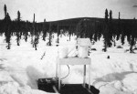
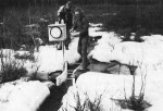
Precipitation and climate parameters are monitored at six sites on a gradient from valley to treeline. Seasonal snowpack is measured monthly at three SCS snow courses, and monitored continuously with a recording snow pillow installation. Since November 1992, precipitation chemistry has been monitored in the Caribou Creek valley (230 m elevation) through the National Atmospheric Deposition Program (NADP). In September 1993, the NADP Program in CPCRW was complemented by operation at treeline (762 m elevation) of a remote aerometric station (in cooperation with Environmental Science and Technology Center, National Biological Survey) which records standard climatic variables and monitors UV-B radiation; continuous air samples are pumped through a filter pack which is changed monthly and analyzed for airborne particulate chemistry.
Opportunities
The composite BNZ/CPCRW research site offers attractive opportunities for scaling ecosystem research from plot to slope to watershed under controlled conditions, over an elevational gradient from floodplain to treeline and over a range of soil, vegetation and permafrost conditions. Several LTER cross-site stream ecology projects have been initiated that include CPCRW, including a conservative tracer release investigation of how various hydrologic parameters vary with location, a study to address carbon dynamics in aquatic ecosystems, and an investigation of large-scale patterns in distribution of microbial biomass in stream ecosystems.
Additional plans include prescribed burning of a 550-ha watershed in lower Poker Creek. Research will address integrated catchment hydrologic response, permafrost thermal regime, landscape stability, water quality, and aquatic biota of the stream, survival, regeneration and succession of terrestrial and riparian vegetation, fuel loading and fire dynamics, and emissions.
The large, carefully documented forest stands in CPCRW and BNZ offer baselines and sites for evaluation of ecosystem response to climate change over the range of important taiga environmental settings. One planned study in CPCRW will monitor organic carbon dynamics in headwater streams with contributing catchments partially underlain by permafrost. From these data, it will be possible to construct a model of the effect of discontinuous permafrost on organic carbon dynamics in streams, and attempt to predict the effects of global warming on the carbon dynamics of subarctic streams.
A complete bibliography for CPCR is available on request. For more information: Charles W Slaughter or John G. Irons III, Aquatic/Land Interactions Research Program, Institute of Northern Forestry, USDA Forest Service, 308 Tanana Drive, Fairbanks, Alaska 99775, 907-474-3311, 474-3350 (FAX), jlrons@LTERnet.edu
 Enlarge this image