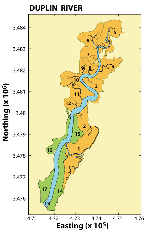
Figure 2: The definition of tidal tributaries and intertidal drainage areas for the Duplin River. The green polygons denote drainage areas having no creeks wider than 5 m. Easting and Northing axis values are given in meters.
Figure 2: The definition of tidal tributaries and intertidal drainage areas for the Duplin River.
Post date:
Apr 18, 2005