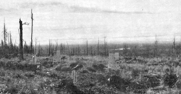
Bonanza Creek Experimental Forest (BCEF) was established in 1963 by the U.S. Forest Service to provide an area for basic and applied research in typical upland and flood-plain landscapes in the taiga of interior Alaska. The area is a part of the Tanana Valley State Forest which is leased to the Forest Service and has a long history of use by scientists from the institute of Northern Forestry and the University of Alaska. in 1983 a wildfire burned through about 2000 ha of the upland segment of the forest and has provided opportunities to study many aspects of secondary succession in a number of different ecosystem types. Forest types on the experimental forest include white spruce, black spruce, paper birch, quaking aspen, and balsam poplar.
The central hypothesis of our LTER study is that the pattern of succession in determined primarily by initial site characteristics and by the life history traits of component species and that the rate of successional change is then determined by vegetation-caused changes in environment and ecosystem function. We are testing this hypothesis both on the uplands, where secondary succession is initiated by fire, and on the flood plain of the Tanana River where major flood events trigger primary succession.
Since 1988 was our first full year of operation, major effort was placed on establishing permanent study plots and climate monitoring stations. We have installed two permanent weather stations within Bonanza Creek Experimental Forest -- one on the flood plain of the Tanana River (120 m elevation) and the other on a broad ridge about midway in an elevational transect in the Forest (290 m elevation). Electronic data loggers are being used to monitor these sites year round. Parameters measured include air temperature, relative humidity, soil temperature, soil moisture, precipitation, evaporation, wind sped and direction, radiation, and depth of frost in the soil. All climatic data are stored in a relational menu-driven database and monthly summary reports are being produced which are available upon request.
Weather data from the National Weather Service station at Fairbanks were used to compile a long term synopsis of BCEF climate. A strongly continental climate is indicated by temperature extremes which range from -50 to + 35°C. The mean annual temperature of -3.3°C results in the formation of permafrost on north-facing slopes and poorly drained lowlands. July is the warmest month with mean daily temperature of 16.4°C and January is the coldest with an average temperature of -24°C. Annual precipitation of 269 mm falls primarily in the summer months, while winter precipitation (about one third of the total) remains as a permanent snow cover for 6 to 7 months of the year. The amount and seasonal distribution of precipitation is almost identical to that of the Jornada LTER site in New Mexico.
Our field experimental design consists of three replications of seven turning points in the two successional sequences. Both sequences lead to white spruce and begin with a recently burned area In the uplands and young alluvial deposits on the flood plain. Three turning points were located In the uplands and four on the flood plain. We use the term turning point to emphasize the fact that in relatively short time intervals critical changes in ecosystem structure are accompanied by functional changes which have far-reaching effects on ecosystem development. Each site has a 50 x 60 m control plot designed for long term monitoring of the ecosystem. In addition, there are either three or four 30 x 40 m treatment plots depending on the experiments planned for that site. This design results in a total of 15 ha of actual plot area.
There is also sufficient area adjacent to the established plots for experimental sites which may be required in the future. During 1988 we concentrated on locating all 21 experimental sites and physically marking plot boundaries on the ground. The initial vegetation and soil inventories have been completed In two thirds of the control plots. Seedfall and lltterfall monitoring have also been initiated. These initial inventories will be completed during the 1989 field season as well as stem mapping and downed tree inventory. in addition, climatic stations have been established at one control plot In each of the seven turning points in order to monitor abiotic changes occurring with succession.
This coming field season (1989) we will also complete the installation of several long term experiments. These include:
- Altering resource availability by adding nitrogen, sawdust, or sucrose or by limiting precipitation input
- The natural pattern of colonIzation and succession will be altered by planting artificial communities in early succession (vegetation-free silt, N-fixing aider, spruce, or alder + spruce)
- Moss will be removed to document the role of mosses in controlling soil temperature and nutrient cycling
- Herbivores will be excluded from some artificial communities. Measurements planned for these experiments Include plant establishment and growth, soil nutrient availability, biomass and standing stocks of nutrients, soil microbial and invertebrate activity, and secondary metabolite concentrations in plants and forest floor.
The scientists at Bonanza Creek Experimental Forest encourage others who are interested to enter into cooperative research in these fascinating subarctic ecosystems.
If you would like additional information, contact Dr. Keith Van Cieve, Agricultural and Forestry Experiment Station, University of Alaska, Fairbanks, AK 99775.

